General1 month ago
Where on this map should I fish? Its just outside of eg simmons in tampa bay and the two red dots are known artificial reef spots.
1 month ago·FishGPT Basic AI
Related Videos

Reef Fishing 101: Learn From A Charter Captain How To Fish Reefs | Boatsetter

Kayak fishing Southern California - how to find fish using contour maps with my Garmin fish finder.

Scarborough Fishing, shallow reef, MAPS and SPOTS

Fishing Harry Atkinson Reef

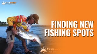
How You Can Use Smart Fishing Spots To Catch Fish In New Areas

Islamorada Patch Reef Fishing

Fishing the Artificial Reef off Bundaberg

So many fish on this reef! Fishing new ground

Oyster Reefs 101 How To Find Fishing Spots Port Aransas Aransas Pass Rockport Charter
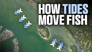
How Tides Move Fish (And How to Catch Them!)

Using GOOGLE EARTH to find FISHING SPOTS: HOW TO FISH in the WIND

How To Clinic: Fishing Public Artifical Reefs

Using New Hotspots Tool To Find Monster Fish On Reefs And Wrecks
![Fishing Nearshore Reefs The EASY Way [Shortcuts & Hints!!]](https://i.ytimg.com/vi/gWob-Huphoo/mqdefault.jpg)
Fishing Nearshore Reefs The EASY Way [Shortcuts & Hints!!]
Find new fishing spots by doing reconnaissance at low tide

DEEP DROP FISHING SPOTS MAP: Florida Gulf Panhandle

Artificial Reefs built for Fishing in Orange Beach, Alabama

Google Earth Fishing - Tampa/St. Pete Reef Overview

Google Earth Fishing - Destin Reef Overview

Satellite Maps For Fishing: How To Identify Seagrass From Muddy Bottom
Product Recommendations


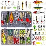

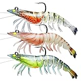
Affiliate Disclosure: Some links may earn a commission
Community
Loading reactions...
Sign in to add comments or likes. You can still read what others are saying.
🎣 E.G. Simmons Regional Park, Tampa Bay, Florida
bay fishing27.7500, -82.7200


